The lost buildings of Hilly Fields
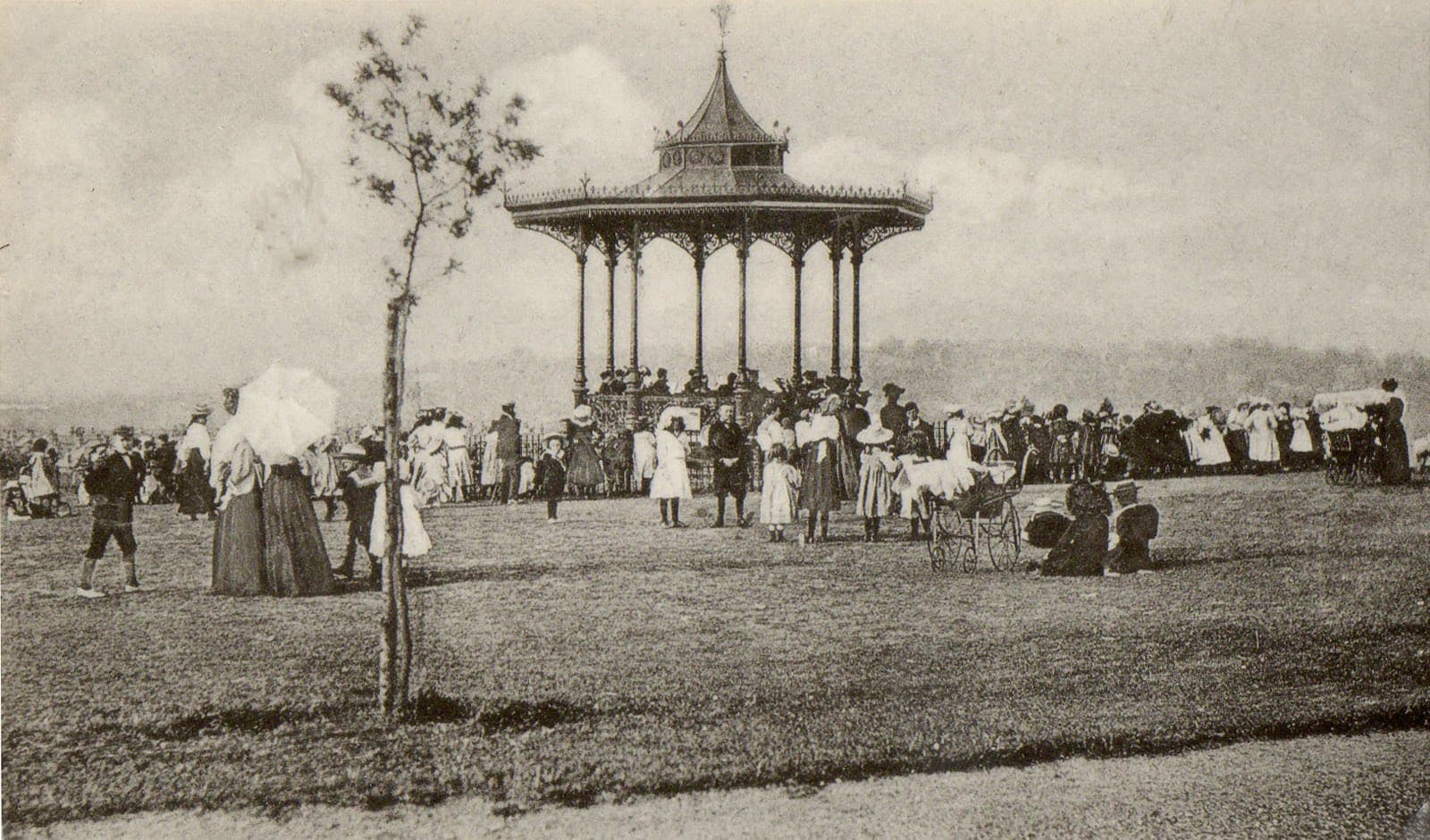
The bandstand in Hilly Fields, one of the park's lost buildings, photographed around 1906
In a long, dry summer the grass of Hilly Fields sometimes gives up its secrets. Differences in the soil below make some patches fade faster than others, and pale shapes appear where old foundations and drains once lay. When the park opened in 1896 it was laid out with a small group of buildings, among them a bandstand, a refreshment house and shelters. Most have since gone.
A park saved from the builders
Hilly Fields was dedicated to the public on 16 May 1896.[1] The land had almost gone the other way. It was mostly farmland, with an area of game shooting to the south, and had already been leased to developers.[1]
The person who changed that was Octavia Hill, later one of the three founders of the National Trust. She learned that wild flowers picked on Hilly Fields were brightening a poor room in Deptford, and came to see the place for herself.[1] With the Commons Preservation Society and other groups behind her, she helped local people raise funds and press for the land to be kept open.[2]
The London County Council bought the ground, backed by donations from charities and City companies, and preserved it as a park.[1]
Sexby's plan for the hill
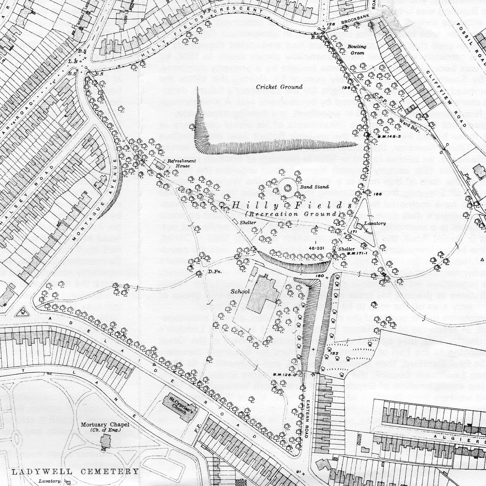
The LCC laid out the new park to a design by its chief officer of parks, Lieutenant Colonel J. J. Sexby.[2] His scheme shaped the paths and planting of the open hillside and gave it a set of buildings for the visitors it hoped to draw: a refreshment house near the Montague Avenue entrance, an ornate bandstand towards the centre, and shelters along the walks.[2][3]
The 1914 Ordnance Survey map records them together. It marks the refreshment house on the north-west side, the "Band Stand" as a small circle near the middle of the recreation ground, two shelters and a lavatory, all set among the cricket ground, the bowling green and the school that pre-dated the park.[3]
The bandstand
The bandstand was the showpiece. A photograph taken around 1900 shows how elaborate it was: an open-sided pavilion, ringed by paths and newly planted trees, which gave the park a focus for music and public gatherings.[4] Another view, dated to between about 1900 and 1930, records the same building.[5]
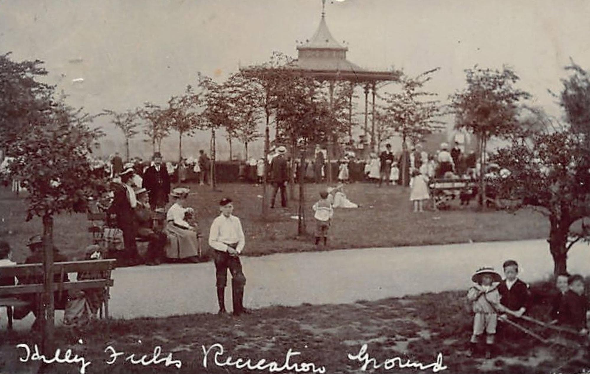
An Edwardian postcard captioned "Hilly Fields Recreation Ground" captures one such gathering, with a large crowd in their best dress around the bandstand on a fine day.[7]
The bandstand was still standing in 1924.[2] At some point after that it came down, and the exact date is not recorded. Its circular outline still surfaces in dry weather, on the grass beside the outdoor gym near the eastern edge of the park. Its memory also survives through archive photographs and a modern mural on the park café.[2]
The refreshment house
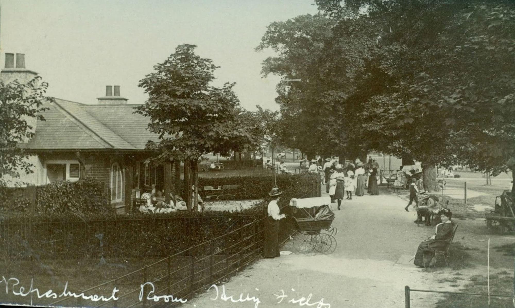
Near the Montague Avenue entrance stood the refreshment house, where visitors could buy tea and rest under the trees.[3] An Edwardian postcard records it: a low pavilion with a covered veranda, busy on a summer afternoon, prams by the railings and a tree-lined walk running past.[8]
The marks in the grass
The buildings are gone, but the ground remembers them. On the north-west side of the park, towards Montague Avenue, dry weather has revealed the outline of a building, complete with what looks like a drain cover.[6]
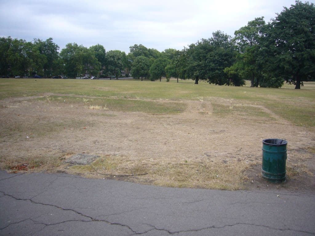
The 1914 map points to the answer. The refreshment house stood on this same side, beside the path near the Montague Avenue entrance, and its position matches the marks, down to the drain that would have served a building with a kitchen and tea room.[3][8] When the outline was first shared, before the map was consulted, the guess was wartime huts, but the earlier plans make the refreshment house the far likelier source.[6]
In dry weather, when the old patterns rise to the surface, Hilly Fields becomes a faint map of its own past, and for a few weeks the buildings that once stood on this Brockley hillside show through the grass.
Sources
- 1.^
London Borough of Lewisham, Hilly Fields — lewisham.gov.uk
- 2.^
Hilly Fields, Lewisham, Wikipedia — en.wikipedia.org
- 3.^
Brockley Central, I remember when all this was trees — the buildings of Hilly Fields, 2011 — brockleycentral.blogspot.com
- 4.^
University of Greenwich, Bandstand, Hilly Fields, Brockley, c. 1900, Ideal Homes archive — ideal-homes.gre.ac.uk
- 5.^
Hilly Fields bandstand, c. 1900–1930, Historypin — historypin.org
- 6.^
Brockley Central, Hilly Fields: The Mark of Cain, 2010 — brockleycentral.blogspot.com
- 7.^
Luke Anthony Briscoe, Hilly Fields Recreation Ground postcard, posted in the Facebook group Catford and Lewisham - way back when, 2022 — facebook.com
- 8.^
Luke Anthony Briscoe, Refreshment Room, Hilly Fields postcard, posted in the Facebook group Time Travellers Guide To The Borough Of Lewisham, 2025 — facebook.com